Satellite imagery shows extent of flooding in regional Victoria
3 years ago
4.06K
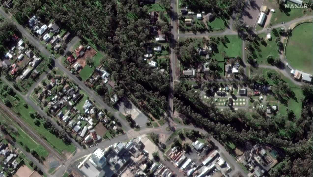
Satellite imagery shows the extent of flooding in the Australian town of Rochester, after heavy rain caused floods across the state of Victoria. This footage sent to Storyful by Maxar Technologies shows before and after images of the floods in Rochester, taken on October 15 and 16. Credit: Maxar Technologies via Storyful. BE ON IT with the latest news and lifestyle videos: www.news.com.au bit.ly/3pGT90C
Loading comments...
-
 11:13
11:13
MattMorseTV
18 hours ago $42.50 earnedRINO PLOT just got SHUT DOWN.
54.8K146 -
 31:07
31:07
Camhigby
3 days agoLeftist Claims Gender Goes By Identity, Then FLOUNDERS When Asked This Question!
152K83 -
 LIVE
LIVE
Shield_PR_Gaming
4 hours ago11/22/25 I Let's Level up on Battlefield and other games as well!
227 watching -
 10:21
10:21
MetatronGaming
10 hours agoI spent $200 for this Premium PS5 Controller. Is it worth it?
16.6K8 -
 13:46
13:46
Nikko Ortiz
18 hours agoYour Humor Might Be Broken...
48.5K5 -
 1:20:58
CopperheadRoadPodcast
1 day agoEPISODE 91: DAVE SMITH HAS A TRIGGERNOMETRY PROBLEM! GUEST Larry Oberheu
4811 -
 26:35
26:35
The Bryce Eddy Show
20 hours agoDaniel Harmon: The Storytelling Genius Behind Tuttle Twins
415 -
 46:47
46:47
The Heidi St. John Podcast
1 day agoFan Mail Friday: Holding the Line in a Divided Culture
403 -
 9:26
9:26
MattMorseTV
1 day ago $48.20 earnedPam Bondi is in HOT WATER.
67.2K227 -
 16:38
16:38
MetatronGaming
16 hours agoAnno 117 Pax Romana looks INCREDIBLE
91.6K12