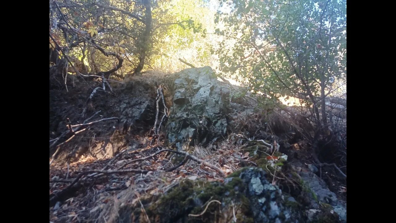
Rock Outcrop Along the Stevens Canyon Trail
An up close look at a bedrock outcrop on the North American side of the San Andreas fault and the Canyon Trail in Montebello Open Space Preserve.
Sorry about the video quality, my camera was having issues with the difficult lighting conditions.
The surface rocks along the stretch of the Canyon Trail where USGS shows the creek flowing are almost all angular. Aside from some minor rounding from decades of hoot, horse and bicycle travel, the rocks are all sharp and angular. This is in contrast to the well rounded rocks found in the bed of Stevens Creek. Also, many of the rocks in Waterwheel Creek proper are coated in Travertine from the minerals dissolved in that water.
Rock outcrop may be a Greenstone or similar type of metamorphosed basalt of the Franciscan Complex:
https://en.wikipedia.org/wiki/Franciscan_Complex
I was hoping to find a sedimentary rock to look at layering, but that type of rock is not as common on this side of the fault.
Geologic Analysis Of The Monte Bello Ridge Mountain Study Area paper:
https://fbdroch.com/book/environmental-geologic-analysis-of-the-monte-bello-ridge-mountain-study-area-santa-clara-county-california
From that paper:
"TECTONIC BLOCKS - Large angular to rounded, commonly elliptically shaped masses of relatively hard rocks surrounded by a clay-rich, sheared matrix. Occurs within shear zones and fault gouge. In the shear zones of the Franciscan rocks, these blocks range from "fist size" to masses more than one mile long."
USGS National Map Viewer w/ Hill Shade:
https://apps.nationalmap.gov/viewer/
About the USGS HTMC:
https://www.usgs.gov/programs/national-geospatial-program/historical-topographic-maps-preserving-past
View/download maps on the TopoView site:
https://ngmdb.usgs.gov/topoview/
Section of single track Canyon Trail built in 1990:
https://www.trailcenter.org/newsletter/2000/winter2000/winter2000-19f.htm
Future plan: I want to try to hike along the top of the ridge between the Canyon Trail and Stevens Creek between the Table Mtn. and Grizzly Flat trails. I'm hoping there might be some exposed sedimentary rock outcrops up there that might show if this block has been tilted in the past.
More to come...
Subscribe for more content like this
Comment, rate, share & click the bell icon
And as always, thanks for watching
#USGS #HillShade
-
 LIVE
LIVE
Lofi Girl
3 years agolofi hip hop radio 📚 - beats to relax/study to
3,714 watching -
 1:20:23
Man in America
11 hours agoHow Epstein Blackmail & FBI Cover-Ups Are Fracturing MAGA w/ Ivan Raiklin
178K25 -
 2:13:49
Inverted World Live
6 hours agoSolar Storms Ground 1000 Planes | Ep. 151
106K5 -
 2:54:08
TimcastIRL
6 hours agoJ6 Pipe Bomb Suspect ARRESTED, Worked With BLM, Aided Illegal Immigrants | Timcast IRL
249K121 -
 3:59:02
Alex Zedra
5 hours agoLIVE! Bo7 Warzone
33.4K1 -
 4:37:35
Drew Hernandez
1 day agoCANDACE OWENS / TPUSA STALEMATE & DC PIPE BOMBER CAPTURED?!
57.1K33 -
 12:31
12:31
Robbi On The Record
7 hours ago $4.70 earnedWhy Nothing Feels Real Anymore | The Science, Culture, and Spiritual War Behind the Fog
41.8K9 -
 18:42
18:42
Navy Media
7 hours agoHouthis ATTACK the Wrong U.S. Fighter Jet – Then THIS Happened…
44.2K40 -
 40:24
40:24
MetatronGaming
1 day agoSomething is REALLY Wrong with this apartment...
34K2 -
 LIVE
LIVE
SpartakusLIVE
7 hours agoHUGE NEW UPDATE - Aim Assist NERF, New META, New MOVEMENT || #1 King of Content
796 watching