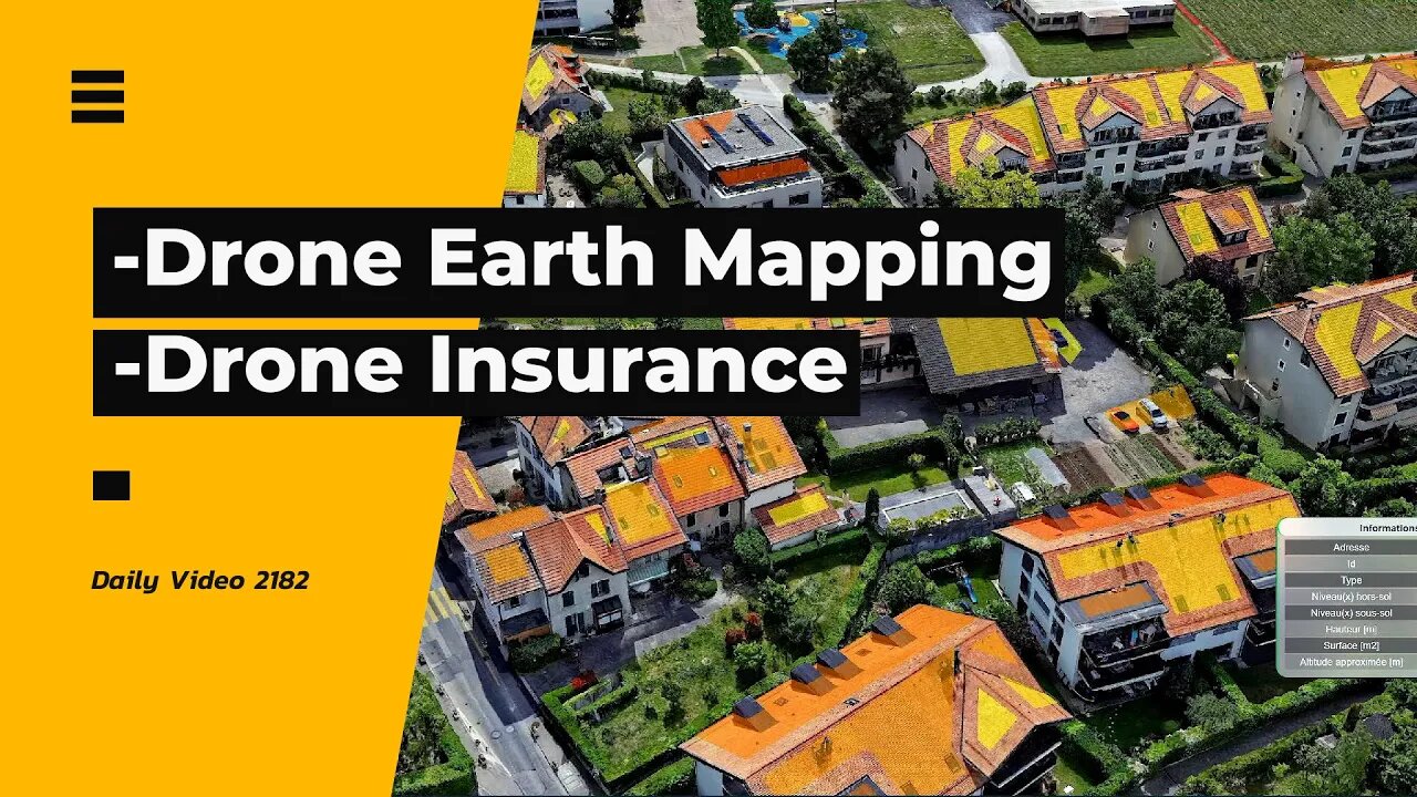
Google Earth Style Mapping With Drones Instead, Public Sector Drone Insurance
2 years ago
3
-Uzufly using aerial photography and videos from drones to create a better Google Earth type of mapping solution
India Assurance launching drone insurance for the public sector covering items such as property damage and injury.
-Squirrels and ducks
-Thermal video of snow and trees
-Drone video of snow and Christmas lights
0:00 Intro
0:17 Drone Mapping
2:35 Drone Insurance
4:20 Wildlife Thermal
5:15 Drone Video
#drone #3dmapping #droneinsurance
Vlog Entry 2182
Loading comments...
-
 2:05
2:05
Alan Yu
29 days ago $0.12 earnedBaby Gosling Wrestling
2261 -
 LIVE
LIVE
MissesMaam
3 hours ago75% DONE WITH PERFECTION!!! | Stardew Co-Op 💚✨
80 watching -
 LIVE
LIVE
Clenzd Gaming
2 hours agoThe Return
49 watching -
 LIVE
LIVE
DeafWarriorLegendary
1 hour ago🔥Deaf Streamer🔥
16 watching -
 2:04:52
TimcastIRL
4 hours agoBomb Threat At TPUSA, Bomb Squad Deployed For Controlled Detonation | Timcast IRL
181K179 -
 2:20:49
Barry Cunningham
3 hours agoBREAKING NEWS: DEMOCRATS SHUT DOWN THE GOVERNMENT! THEY HAVE UNLEASHED PRESIDENT TRUMP
39.6K16 -
 3:59:47
Nikko Ortiz
6 hours agoPTSD Is Fun Sometimes | Rumble LIVE
66.1K3 -
 23:02
23:02
Jasmin Laine
8 hours ago"Carney BROKE Ethics Laws!"—Liberal SPEECHLESS After Being Cornered On CTV
19K18 -
 31:50
31:50
iCkEdMeL
4 hours ago $8.58 earnedMassive Protest Shuts Down Downtown Chicago Over ICE Crackdown
66.8K82 -
 17:17
17:17
Scammer Payback
9 hours agoHolding a Scammer's Computer HOSTAGE
17.2K2