USA Landsat Croplands Data Overview - NASA / ASTROSPECTRE
2 years ago
10
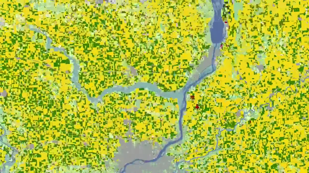
The U.S. Department of Agriculture tracks how many acres and the annual yield for every crop produced. One method used to estimate crop acreage and yield is remote-sensing data from the NASA-USGS Landsat satellite program. The program started in 1997,with North Dakota, and by 2008 covered the entire lower 48 states and the District of Columbia
#moon #orbit #space #earth #astro #astronomy #outerspace #nasa #cosmicdiscoveries #spacediscoveries #mercury
Loading comments...
-
 LIVE
LIVE
The Charlie Kirk Show
52 minutes agoUrban Insurrection? + Biggs for Governor + Red New Jersey? | Halperin, Rep. Biggs, Maloney|10.7.2025
5,746 watching -

Steven Crowder
3 hours agoDid You Vote for This: Why The Podcast Bros are Turning on Trump
239K233 -
 1:08:40
The Rubin Report
2 hours agoListen to ‘The View’ Crowd Gasp as Whoopi Tells Super Bowl Crowd to Do This
20.3K25 -
 LIVE
LIVE
LFA TV
14 hours agoLIVE & BREAKING NEWS! | TUESDAY 10/7/25
3,944 watching -
 LIVE
LIVE
The Mel K Show
48 minutes agoMORNINGS WITH MEL K -Overwhelming Evidence of Grand Conspiracy Against We the People 10-7-25
749 watching -
 LIVE
LIVE
The Shannon Joy Show
11 hours agoEugenics, Vaccination & The Unholy Trump/Pfizer Alliance LIVE W/ Brook Jackson & Warner Mendenhall
244 watching -
 31:12
31:12
Grant Stinchfield
1 hour agoWhen Science Became Propaganda
3.9K4 -
 LIVE
LIVE
Trumpet Daily
1 hour agoTrumpet Daily LIVE | Oct. 7, 2025
248 watching -
 1:00:59
VINCE
3 hours agoWho Else Were They Spying On? | Episode 141 - 10/07/25
189K124 -
 1:46:37
Dear America
4 hours agoBIDEN FBI CAUGHT SPYING!! Jack Smith Tracked Calls of DOZENS Of Senators!! JAIL NOW!!
95.4K46
