Seeing Satellite Benefits on the Ground with the National Park Service
2 years ago
6
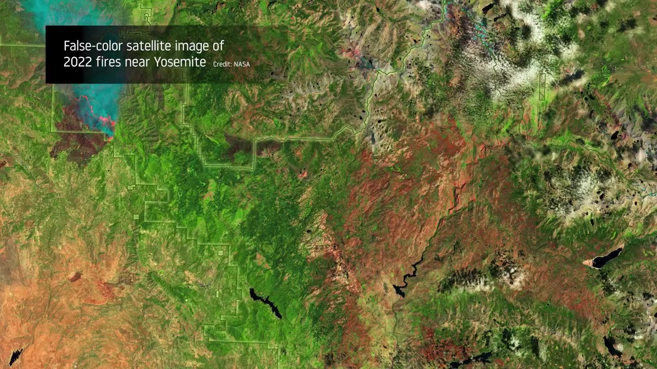
From the hoodoos in Bryce Canyon to the caves of Carlsbad Caverns and the giant sequoias of Yosemite, did you know researchers use NASA satellite data in National Parks?
Our view from space can help monitor water resources, assess air quality, analyze fire patterns, track vegetation changes, and more. It all helps the National Park Service make informed decisions for protecting and restoring America’s most beautiful natural spaces.
This video can be freely shared and downloaded. While the video in its entirety can be shared without permission, the music and some individual imagery may have been obtained through permission and may not be excised or remixed in other products.
For more information on NASAvedioknowledge
Loading comments...
-
 LIVE
LIVE
Wendy Bell Radio
4 hours agoEnemy of the State
7,203 watching -
 1:07:36
Chad Prather
19 hours agoThe Power You Cannot Buy: Motives, Power, and the Making of a True Disciple
59.8K17 -
 LIVE
LIVE
LFA TV
12 hours agoLIVE & BREAKING NEWS! | THURSDAY 12/04/25
2,850 watching -
 LIVE
LIVE
The Chris Salcedo Show
12 hours ago $3.54 earnedDispelling Narrative Over Facts On Racism
555 watching -
 16:09
16:09
T-SPLY
17 hours agoFederal Agents Arrest Non Citizen Police Officer — Department Hires Him BACK!
40.7K39 -
 12:55
12:55
World2Briggs
19 hours ago $4.66 earnedTop 10 States With The Worst Weather | Natural Disasters
24.4K -
 21:52
21:52
The King of Camo
21 hours agoGOALS 2026 Range Day
20.6K2 -
 48:22
48:22
A Cigar Hustlers Podcast Every Day
1 day agoEpisode 421 Cigar Hustlers Podcast Every Week Day Rage Bait
24.6K3 -
 2:05:49
BEK TV
1 day agoTrent Loos in the Morning - 12/04/2025
20K2 -
 2:55
2:55
Canadian Crooner
2 years agoPat Coolen | Christmas Blues
50.2K1