Export DWG 3D to Google Earth in "Topography in AutoCAD or BricsCAD" software
1 year ago
54
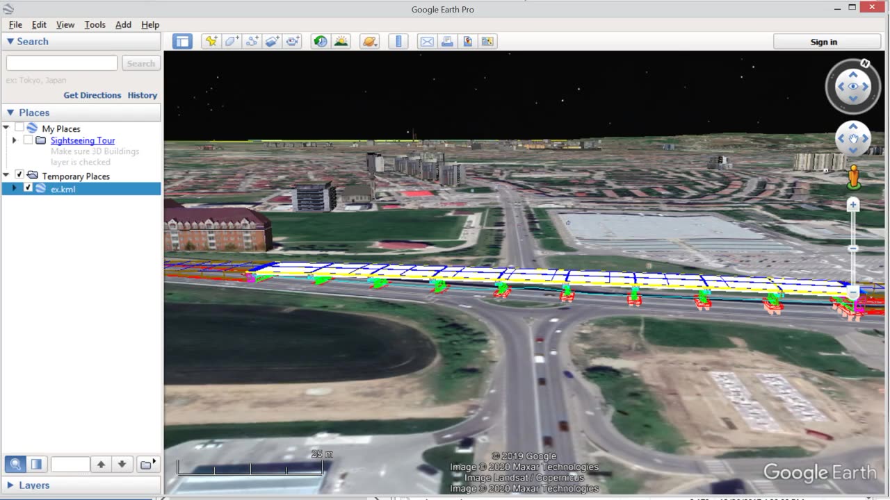
"Topography in AutoCAD or BricsCAD" software can draw a 3D DWG file in Google Earth, by generating a 3D KML file type. The program is an add on for AutoCAD or Bricscad.
In the example is a bridge designed with the BRIDGE program.
https://rcad.eu/triangulation-autocad/
https://rcad.eu/bridge/
Loading comments...
-
 3:53
3:53
NAG Daily
21 hours agoRUMBLE RUNDOWN: DREAM HACK SPECIAL W/Greenman Reports
10.5K6 -
 1:28
1:28
Damon Imani
1 day agoThey Laughed at Trump’s Cognitive Test — Damon Made Them REGRET It!
16.9K8 -
 9:14
9:14
Freedom Frontline
23 hours agoAdam Schiff PANICS As Eric Schmitt Exposes His Dirty Lies LIVE
11.3K8 -
 10:32
10:32
GBGunsRumble
1 day agoGBGuns Armory Ep 153 Adler Arms AD-9`
8.43K1 -
 35:53
35:53
Degenerate Plays
3 hours ago $0.23 earnedRuckus Randy And Repair Ronald (Socks On) - Call of Duty: Modern Warfare 2 (2009) : Part 7
5.28K1 -
 38:35
38:35
Stephen Gardner
1 day ago🔥What JUST leaked out of Congress. PROVES Trump RIGHT!!
97.7K132 -
 LIVE
LIVE
Total Horse Channel
16 hours ago2025 IRCHA Derby & Horse Show - November 2nd
59 watching -
 1:59:42
Game On!
22 hours ago $44.98 earnedNFL Week 9 Wise Guy Roundtable BEST BETS!
146K15 -
 2:18:53
Badlands Media
23 hours agoDevolution Power Hour Ep. 403: Brennan Exposed & The Intel War w/ Thomas Speciale
467K142 -
 4:34
4:34
Legal Money Moves
5 days agoThe AI Panic: Are You Next?
53.6K10