
How Do Hurricanes Form? Meteorology - Weather Basics
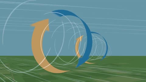
What Causes a Tornado? - Meteorological Basics

NOAA: 'The Hurricane Hunters'

What is the Enhanced Fujita Tornado Scale - Weather Basics - Meteorology
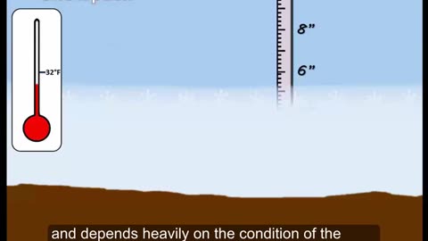
What is a Blizzard? Weather Basics - Meteorology
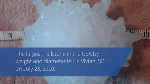
The Science of Hail - Meteorology - Weather Basics
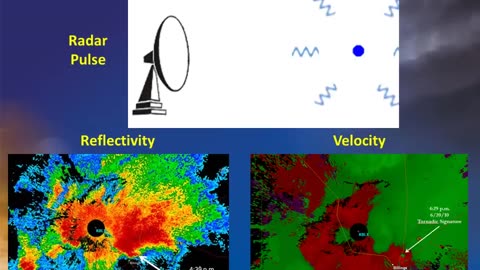
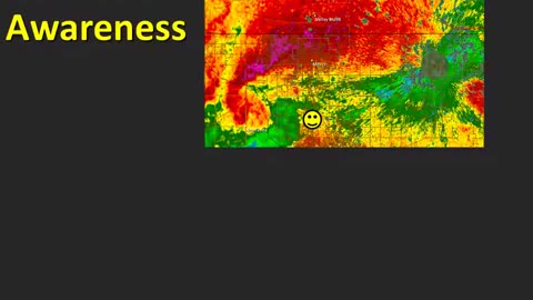
Doppler Weather Radar Basics - Weather Basics - Meteorology
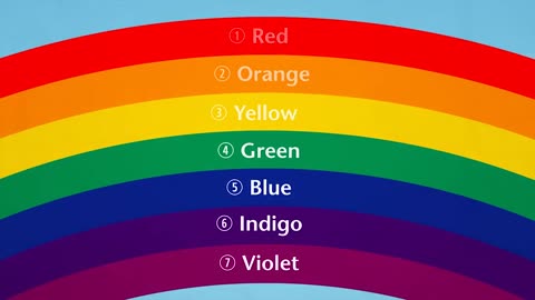
How Do Rainbows Form? - Weather Basics

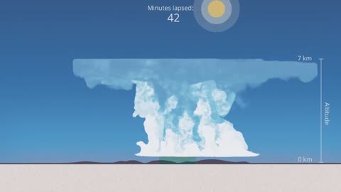
Thunderstorm Types - Meteorology - Weather

How Does Rain Form? What is the Water Cycle?
Hurricanes - Weather Basics - Meteorology 101

The Science Behind Lightning - Meteorology

How does snow form? - Meteorology
Storm Spotting: Storm Motion and Positioning- Meteorology
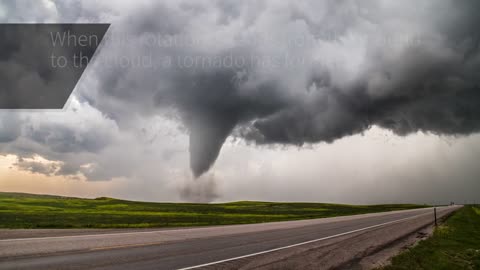
The Science Behind Tornadoes - Meteorology
A Tutorial on Cloud Types - Weather 101 - Meteorology
NOAA: 'The Hurricane Hunters'
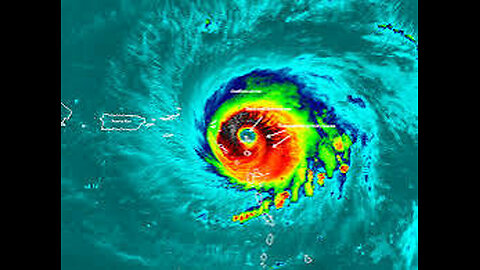
A hurricane hunter is a pilot brave enough to fly an airplane into the middle of a hurricane to gather data on temperature, humidity, pressure, etc. This data is critical for forecasting the intensity and path of hurricanes.
NOAA pilots, planes and researchers fly into the world's worst weather.
Data collected by the agency's high-flying meteorological stations help forecasters make accurate predictions during a hurricane and help hurricane researchers achieve a better understanding of storm processes, improving their forecast models.
P-3 Orion: Into the Storm
Slicing through the eyewall of a hurricane, buffeted by howling winds, blinding rain and violent updrafts and downdrafts before entering the relative calm of the storm’s eye, NOAA’s two Lockheed WP-3D Orion four-engine turboprop aircraft, affectionately nicknamed "Kermit" (N42RF) and "Miss Piggy" (N43RF), probe every wind and pressure change, repeating the often grueling experience again and again during the course of an 8-10 hour mission.
Scientists aboard the aircraft deploy Global Positioning System (GPS) dropwindsondes as NOAA Corps officers pilot and navigate the P-3 through the hurricane. These instruments continuously transmit measurements of pressure, humidity, temperature, and wind direction and speed as they fall toward the sea, providing a detailed look at the structure of the storm and its intensity. The P-3s' tail Doppler radar and lower fuselage radar systems, meanwhile, scan the storm vertically and horizontally, giving scientists and forecasters a real-time look at the storm. The P-3s can also deploy probes called bathythermographs that measure the temperature of the sea.
More More Meteorology Videos
https://rumble.com/playlists/JfAj918PQuc Videos
https://rumble.com/playlists/JfAj918PQuc
-

LIVE WITH CHRIS'WORLD
10 hours agoTHE WAKE UP CALL - 12/11/2025 - Episode. 23
20.6K3 -
 5:12
5:12
Blackstone Griddles
14 hours agoApple Pie Pancakes on the Blackstone Camping Griddle
3.76K2 -
 44:02
44:02
CarlCrusher
23 hours agoFormer Green Beret Mike Battista can Summon UAP using Psionics - Part 4
5.03K7 -
 44:31
44:31
Damon Imani
16 hours agoDamon VS The View | Best of 2025
4.13K4 -
 28:31
28:31
Living Your Wellness Life
18 hours agoShould You Shower Every Day?
6.31K4 -
 1:00:36
A Cigar Hustlers Podcast Every Day
1 day agoHustler Every Week Day Episode 426 "What To Know Before Its To Late!"
3.97K1 -
 LIVE
LIVE
BEK TV
23 hours agoTrent Loos in the Morning - 12/11/2025
151 watching -
 1:34:34
Tucker Carlson
10 hours agoWhy Are We Defending Mass Murder in Gaza? Because Our Greatest Ally Demands It
90.3K428 -
 30:01
30:01
James Klüg
16 hours agoA Murder Capital of America Protests ICE DEPORTING Criminals
12.4K17 -
 26:10
26:10
Michael Knowles
16 hours agoFormer Diddy Escort Reflects on Turning to Christianity | Michael & Shawn Dearing
22.5K13