Port-Au-Prince via Satellite
1 year ago
18
Jan 15, 2010
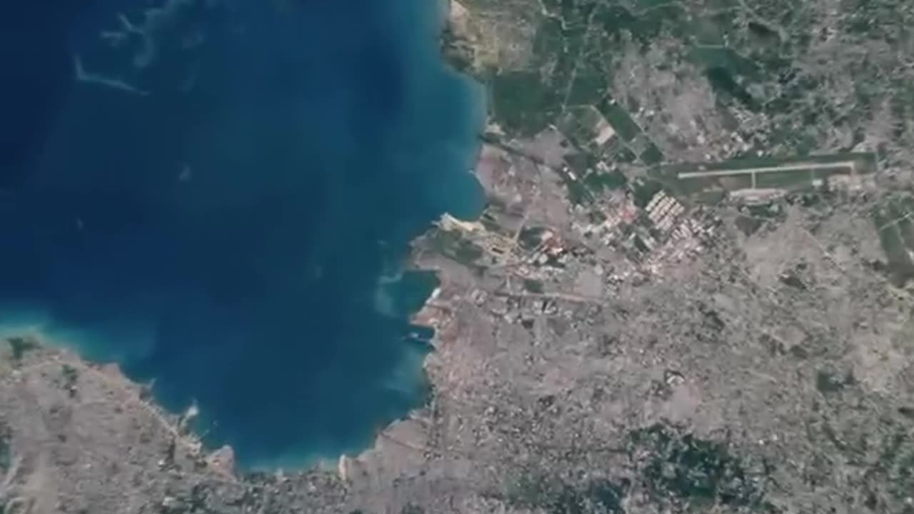
NASA's Earth Observing-1 satellite captured this image of Port-au-Prince, Haiti, on the morning of Jan. 15, 2010. The image shows the densely built and densely populated capital city. Satellite images like this one, when compared with similar images taken before the earthquake, will provide information to support disaster recovery efforts in Haiti. Data from the Advanced Land Imager on the satellite.
Image processed by NASA's Earth Observatory, Goddard Space Flight Center
For more info: www.nasa.gov
Loading comments...
-
 LIVE
LIVE
The Rabble Wrangler
11 hours agoBattlefield "Deputy Games" with The Best in the West!
1,036 watching -
 2:03:43
TimcastIRL
9 hours agoTrump Declares Antifa FOREIGN Terrorists, It Has Begun | Timcast IRL
225K111 -
 2:56:34
Parallel 8 Media
4 hours agoFriday Night Huddle - Ep 31- Julie Donuts, Rachel & Betsy
22.2K2 -
 5:03:56
Illyes Jr Gaming
14 hours agoCall Of Duty Black Ops 7 LAUNCH DAY!!!!
12.1K -
 4:21:52
Drew Hernandez
22 hours agoTUCKER CLASHES W/ FBI, TRUMP PUSHES EPSTEIN DISCLOSURE AFTER HOAX CLAIM & IS MEGYN KELLY IN DANGER?
35.6K16 -

Phyxicx
4 hours agoRumble Spartans Halo Night! - HMR#20 - 11/14/2025
13.3K -
 10:15:18
FusedAegisTV
1 day ago*NEW F2P MMORPG, SoulsLike/Action Game // Global LAUNCH - EN Servers 🔴 FUSEDAEGIS
31.1K1 -
 3:31:00
Barry Cunningham
8 hours agoFOOD STAMPS FRAUD | STARBUCKS BARISTAS BIG MAD | MORE NEWS (AND NO REAL ESTATE!)
86.8K35 -
 LIVE
LIVE
Reidboyy
1 day ago $0.71 earned24/7 BO7 Camo Grind! Stream Doesn't End Until I Unlock EVERY Camo in Black Ops 7!
44 watching -
 2:27:02
TheSaltyCracker
6 hours agoTucker Blows Up FBI ReeEEStream 11-14-25
91.6K182