Where is your Flat Earth Map?! 🤣
Where is your Flat Earth Map?! 🤣
🤣
Addressed. Once and for all
Perhaps now you may understand why I always start with....
WELL.......
What do all worldwide maps project?
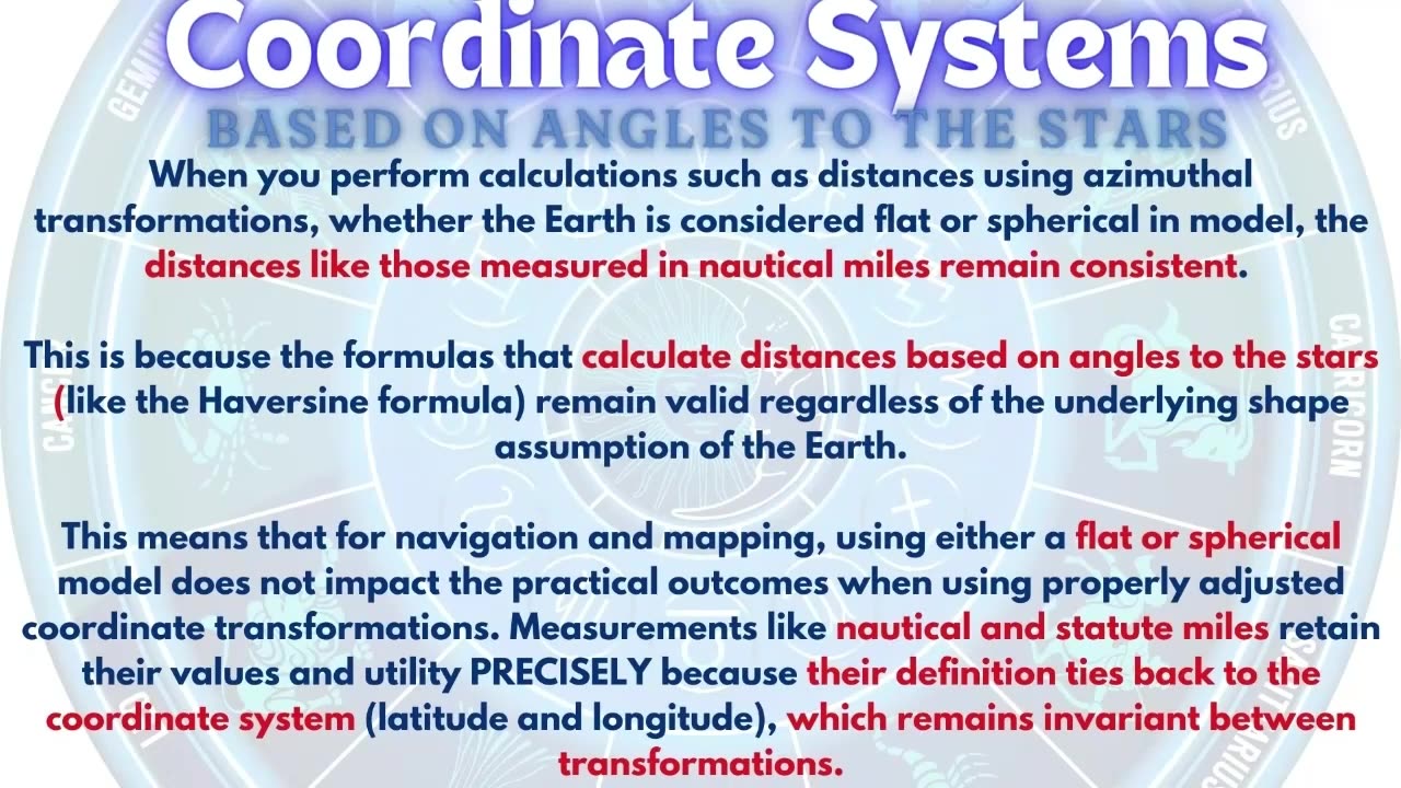
All maps project a coordinate system onto a flat surface. The most commonly used coordinate system is the geographic coordinate system, which models the Earth as a sphere or ellipsoid. This requires a predetermined spherical datum to tie the coordinate system to the actual earth. Most common is wgs84.
This system uses a spherical latitude and longitude system known as the graticule to specify locations on the Earth’s surface. Different map projections then transform these spherical coordinates into a two-dimensional representation, each with its own set of compromises regarding area, shape, distance, and direction.
2) How is latitude determined?
Latitude is determined by measuring the angle between the horizon and a known celestial object,
such as the Sun at its highest point (noon) or Polaris (the North Star) at night. This angle corresponds directly to the latitude of the observer. For example, if Polaris is 30 degrees above the horizon, the observer is at approximately 30 degrees North latitude.
3) How is longitude measured - what observations were crucial in establishing the farthest southern longitudes, as requested by the Board of Longitude in 1714?
Since The geographic coordinate system relies on the positions of celestial bodies to determine latitude and longitude, Taking angles to the stars at various longitudes was a fundamental aspect of properly mapping and refining the geographic coordinate system. They supposedly studied the variations of the night sky, as different stars become visible, and the lunar values - the angular distance between the Moon and a specific star - then compared them with distances listed in the nautical almanac.
4) What are the resultant differences in geodesic surveying, commonly referred to as 'deflection of the vertical', used for in regard to celestial navigation?
The deflections of the vertical are critical for accurate celestial navigation and are accounted for in various ways, including through the use of ephemerides and navigational almanacs.
They incorporate the deflections of the vertical to adjust the observed altitude. The deflections of the vertical are critical for precise celestial navigation. While they are not directly added to the almanac or ephemeris, correction tables or algorithms are used to adjust observed celestial altitudes. These corrections ensure accurate navigation by accounting for local gravitational anomalies, enhancing the reliability of positional data derived from celestial observations. Modern navigational systems and digital tools integrate these corrections
automatically, streamlining the process for navigators.
5) What are any of the 3 stated purposes of astrogeodetic surveying based on? [Based on the document "The Use and Abuse of Vertical Deflections,"]
Transformation of Astronomica
-
 1:56:24
Anti-Disinfo League
1 month agoAether Round Table #104: Community Showcase
458 -
 19:53
19:53
Clintonjaws
3 hours ago $0.77 earnedThey Lied About Charlie Kirk - MAJOR UPDATE
5.74K6 -
 LIVE
LIVE
Midnight In The Mountains™
30 minutes agoArc Raiders w/ The Midnights | THE BEST LOOT RUNS HERE
57 watching -
 LIVE
LIVE
ladyskunk
1 hour agoBorderlands 4 with Sharowen Gaming, Rance, and Sweets! - Part 8
70 watching -
 LIVE
LIVE
S0lidJ
1 hour ago🟢Live -S0lidJ - Solos Arc Raiders
85 watching -

TheItalianCEO
5 hours agoSunday is for chill games
3.49K -
 10:24
10:24
AlaskanBallistics
18 hours agoDiscovery Optics 1-8x28mm LPVO Riflescope Review
1.63K -
 2:08:24
Jeff Ahern
4 hours ago $7.20 earnedThe Sunday Show with Jeff Ahern
13.5K6 -
 27:41
27:41
DeVory Darkins
1 day agoMarjorie Taylor Greene STUNNED after Trump pulls her endorsement
37.8K323 -
 5:06:28
ttvglamourx
5 hours ago $0.73 earnedSUSSY SUNDAY !DISCORD
6.5K