HIKING EXPLORING the Deschutes River Upper Falls Zone IN THE POURING RAIN! | Central Oregon | 4K
Chapters & Timestamps:
0:00 Arriving at the Edge of the EPIC Upper Falls Zone IN THE POURING RAIN!
0:24 Hiking Above the Upper Falls Area, a River Forest Volcanic Lava Rock Wonderland!
0:54 "Silent Perspectives" 4K Montage of 7 Unique Clips of Upper Falls & National Wild & Scenic Upper Deschutes River framed by Deschutes National Forest
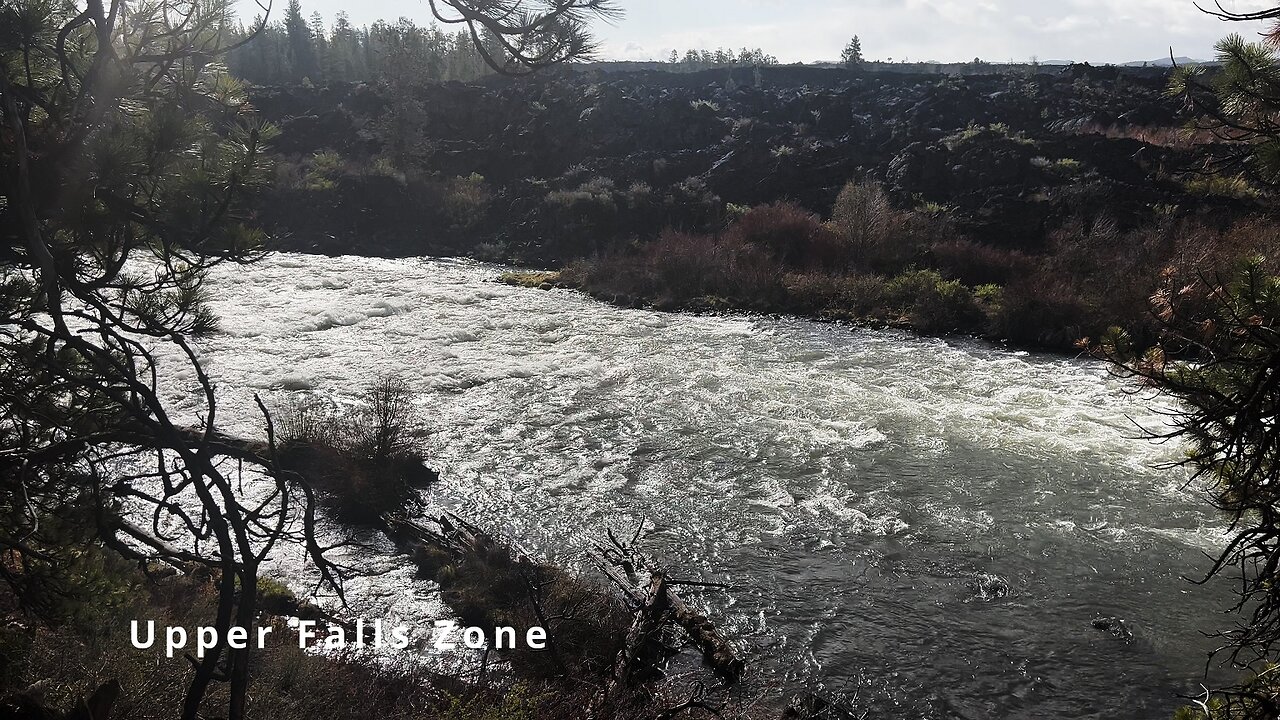
In my opinion, there are about 8 Miles of PREMIUM River Shoreline Hiking on Deschutes River Trail along National Wild & Scenic Upper Deschutes River, Deschutes National Forest, Central Oregon.
This is EASILY a TOP 5 River Shoreline Hike in the Great State of Oregon! There are 3 Strategic Approaches to Capture/Tackle this EPIC area:
1) 8 Mile Point-to-Point Hike from Meadow Day Use Area to Sun-Lava Path Trailhead (called East Benham Falls Trailhead on Google Maps), in either Direction, need to arrange transportation at end of Hike!
2) 16 Mile Out & Back Hike from Meadow Day Use Area to Dillon Falls to Benham Falls to Sun-Lava Path Trailhead (called East Benham Falls Trailhead on Google Maps), in either Direction, no transportation logistics required, the Superstar Hiker Method!
3) Break Deschutes River Trail up into 2 separate more leisurely 8-Miles'ish Out & Back Hikes using Dillon Falls as the Midpoint:
a) Meadow Day Use Area Trailhead to Dillon Falls & Back.
b) Sun-Lava Path Trailhead (called East Benham Falls Trailhead on Google Maps) to Dillon Falls & Back.
On April 22, 2022, I Hiked 8 Miles Point-to-Point from Sun-Lava Path Trailhead (called East Benham Falls Trailhead on Google Maps) heading North to Benham Falls, Slough Day Use Area, Dillon Falls, Aspen Day Use Area, Big Eddy, Upper Falls, Lava Island Day Use Area, Lava Island to Meadow Day Use Area. It was a Low of 29F. Here is the FULL HIKE Video Link of that Hike:
On May 6, 2022, I Hiked 8 Miles Point-to-Point from Meadow Day Use Area Trailhead heading South to Lava Island, Lava Island Day Use Area, Upper Falls, Big Eddy, Aspen Day Use Area, Dillon Falls, Slough Day Use Area & Benham Falls to Sun-Lava Path Trailhead (called East Benham Falls Trailhead on Google Maps). It was a Low of 33F. There was a freak Hail Storm that added to the experience:
-
 1:37
1:37
HikingViking
27 days ago(4K UHD) HIKING HIGHLIGHTS - Deer @ John Day River! | Hunting & Fishing | Cottonwood Canyon | Oregon
65 -
 LIVE
LIVE
LFA TV
16 hours agoLIVE & BREAKING NEWS! | FRIDAY 10/17/25
3,674 watching -
 LIVE
LIVE
Benny Johnson
1 hour agoDC in PANIC: John Bolton DRAGGED Into Federal Court LIVE Right Now in BIG Classified Docs Indictment
5,063 watching -
 LIVE
LIVE
Dr Disrespect
3 hours ago🔴LIVE - DR DISRESPECT - ARC RAIDERS - THE ULTRA EXTRACTION GAME
1,195 watching -
 1:49:03
Dear America
3 hours agoDems Are The Party Of TERRORIST & VIOLENT CRIMINALS! Jon Bolton INDICTED! Trump Threatens Hamas!
72.4K62 -
 LIVE
LIVE
The Big Mig™
2 hours agoJohn Bolton Indicted on the Espionage Act on 18 Federal Counts , Who's Next
5,140 watching -
 LIVE
LIVE
Badlands Media
8 hours agoBadlands Daily: October 17, 2025
3,699 watching -
 LIVE
LIVE
Matt Kohrs
12 hours agoLive Trading Futures & Options || Payday Friday!!!
417 watching -
 1:45
1:45
From Zero → Viral with AI
7 hours agoAI Isn’t Taking Over — It’s Leveling the Playing Field | Work Smarter, Not Harder
9.02K15 -
 1:09:36
Chad Prather
18 hours agoHow to Love Like Jesus in a World That’s Lost Its Heart!
44.1K34