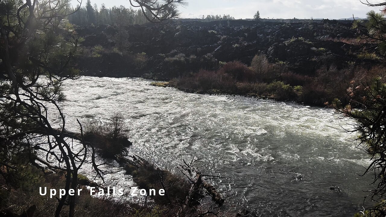
HIKING EXPLORING the Deschutes River Upper Falls Zone IN THE POURING RAIN! | Central Oregon | 4K
Chapters & Timestamps:
0:00 Arriving at the Edge of the EPIC Upper Falls Zone IN THE POURING RAIN!
0:24 Hiking Above the Upper Falls Area, a River Forest Volcanic Lava Rock Wonderland!
0:54 "Silent Perspectives" 4K Montage of 7 Unique Clips of Upper Falls & National Wild & Scenic Upper Deschutes River framed by Deschutes National Forest
In my opinion, there are about 8 Miles of PREMIUM River Shoreline Hiking on Deschutes River Trail along National Wild & Scenic Upper Deschutes River, Deschutes National Forest, Central Oregon.
This is EASILY a TOP 5 River Shoreline Hike in the Great State of Oregon! There are 3 Strategic Approaches to Capture/Tackle this EPIC area:
1) 8 Mile Point-to-Point Hike from Meadow Day Use Area to Sun-Lava Path Trailhead (called East Benham Falls Trailhead on Google Maps), in either Direction, need to arrange transportation at end of Hike!
2) 16 Mile Out & Back Hike from Meadow Day Use Area to Dillon Falls to Benham Falls to Sun-Lava Path Trailhead (called East Benham Falls Trailhead on Google Maps), in either Direction, no transportation logistics required, the Superstar Hiker Method!
3) Break Deschutes River Trail up into 2 separate more leisurely 8-Miles'ish Out & Back Hikes using Dillon Falls as the Midpoint:
a) Meadow Day Use Area Trailhead to Dillon Falls & Back.
b) Sun-Lava Path Trailhead (called East Benham Falls Trailhead on Google Maps) to Dillon Falls & Back.
On April 22, 2022, I Hiked 8 Miles Point-to-Point from Sun-Lava Path Trailhead (called East Benham Falls Trailhead on Google Maps) heading North to Benham Falls, Slough Day Use Area, Dillon Falls, Aspen Day Use Area, Big Eddy, Upper Falls, Lava Island Day Use Area, Lava Island to Meadow Day Use Area. It was a Low of 29F. Here is the FULL HIKE Video Link of that Hike:
On May 6, 2022, I Hiked 8 Miles Point-to-Point from Meadow Day Use Area Trailhead heading South to Lava Island, Lava Island Day Use Area, Upper Falls, Big Eddy, Aspen Day Use Area, Dillon Falls, Slough Day Use Area & Benham Falls to Sun-Lava Path Trailhead (called East Benham Falls Trailhead on Google Maps). It was a Low of 33F. There was a freak Hail Storm that added to the experience:
-
 3:08
3:08
HikingViking
2 months ago(4K UHD) HIKING HIGHLIGHTS - Panoramic Mountain Views @ Black Crater Summit Three Sisters Wilderness
124 -
 2:05:48
Inverted World Live
8 hours agoUFO Seen Over Tokyo During Trump Visit | Ep. 132
63K18 -
 2:54:08
TimcastIRL
7 hours agoDemocrat FEDERALLY INDICTED For Obstructing ICE Agents In Chicago | Timcast IRL
214K99 -
 7:17:25
SpartakusLIVE
8 hours agoNEW - REDSEC Battle Royale || The Duke of Nuke CONQUERS ALL
48.2K8 -
 2:38:39
PandaSub2000
1 day agoNintendo DS Night | ULTRA BEST AT GAMES (Original Live Version)
26.5K20 -
 4:05:07
Alex Zedra
5 hours agoLIVE! Battlefield RecSec
31.4K9 -
 1:26:50
The Quartering
7 hours agoErika Kirk Threatened, SNAP Riots Near, & New AstroTurfed Woke Lib Influencer
60.7K27 -
 29:24
29:24
Glenn Greenwald
8 hours agoSen. Rand Paul on Venezuela Regime Change, the New War on Drugs, MAGA Rifts, and Attacks from Trump | SYSTEM UPDATE #539
131K116 -
 1:45:39
Badlands Media
20 hours agoAltered State S4 Ep. 3: EBT Riots, Shutdown Chaos & The Left’s Cannibalistic Meltdown
62.9K34 -
 2:07:35
This is the Ray Gaming
4 hours ago $0.75 earnedRedacted Sector Day 2 | Rumble Premium Creator
20.9K8