⚠️ Enhanced Severe Storm Threat Today: Tornadoes & Hail Risk!
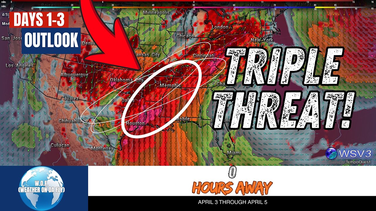
⚠️ Your #1 Source for quick Severe/Tropical Weather Outlooks & Discussions is here! W.O.F. (Weather On da Fly) brings you the latest updates on today's enhanced severe storm threat. Expect tornadoes, large hail, and damaging winds, with the highest risk from the AR/TN region into the Southern Plains. Stay tuned for critical details on how this system develops across Texas, Arkansas, and Missouri into the weekend, as severe weather, including supercells, continues to ramp up. NOAA and SPC models indicate high instability and shear—perfect conditions for strong tornadoes and severe thunderstorms.
Get ready for impactful weather updates this April 2025! Don't miss out—#Share, #Like, and #Subscribe to W.O.F. (Weather On da Fly) for the latest on hurricane season, the tropics, and all severe weather alerts. 🌪️🌩️🌦️
#weatherupdatetoday #damagingwinds #northeasttexas #centraltexasstorms #northtexasweather
CHAPTERS:
00:00 - SPC Outlook
00:08 - Convective Outlook Day 1
01:30 - Convective Outlook Day 2
03:03 - Convective Outlook Day 3
04:19 - Conclusion and Wrap-Up
-
 LIVE
LIVE
LFA TV
22 hours agoLIVE & BREAKING NEWS! | WEDNESDAY 11/12/25
999 watching -
 8:14
8:14
Jamesons Travels
7 hours agoGreen Beret Stopped Playing It Safe & Went AMERICA FIRST
9092 -
 1:24:36
Kim Iversen
3 hours agoTrump Spent “Hours” With Epstein Victim — Possibly Blackmailed
84.2K100 -
 LIVE
LIVE
MattMorseTV
3 hours ago $15.48 earned🔴The House VOTES to RE-OPEN the GOVERNMENT.🔴
1,909 watching -
 10:25
10:25
Faith Frontline
7 hours agoDay in the Life of a First-Century Christian
3.11K -
 1:01:40
The Bryce Eddy Show
1 day ago $0.13 earnedJames Melton: Different Beliefs, Same Problems
6.04K1 -
 1:17:32
CopperheadRoadPodcast
1 day agoEPISODE #87 TATUM'S TRUTH ABOUT CANDACE'S LIES
3.4K2 -
 1:53:34
Redacted News
4 hours agoBREAKING! Trump Holding Emergency Epstein Meeting as House Votes to Release Epstein Files
151K129 -
 2:34:08
Red Pill News
5 hours agoNew Epstein Emails A Dem Distraction on Red Pill News Live
39.7K32 -
 1:02:31
Russell Brand
5 hours agoTrump takes on BBC while Britain burns - SF649
145K56