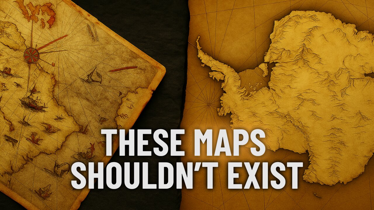
These Ancient Maps Knew What We Weren’t Supposed to Know
Three maps. Three centuries. One impossible truth.
Long before Antarctica was even discovered, these ancient maps somehow showed its exact shape — beneath thousands of feet of ice.
From the Piri Reis Map of 1513 to the Zeno and Orontius Finaeus charts, these cartographers claimed to be copying even older source material — maps that no longer exist.
But what they preserved might change everything we thought we knew about history.
—
🧭 What’s covered in this video:
Piri Reis Map — How did a 16th-century Ottoman admiral map Antarctica under the ice?
Zeno Map — A Renaissance-era depiction of Greenland’s subglacial terrain… centuries before radar
Orontius Finaeus Map — A complete topographic outline of Antarctica drawn in 1531
All three maps describe “older source materials” — but where did those come from?
—
🔍 Subscribe for more lost history, ancient technology, and forbidden discoveries.
📺 Also on YouTube: Late Night Top 5
—
📌 Weekly long-form videos. Daily mystery Shorts.
-
 LIVE
LIVE
The Chris Salcedo Show
18 hours ago $9.81 earnedDemocrat's House Of Cards Continues Historic Collapse
581 watching -
 1:07:18
Julie Green Ministries
2 hours agoLIVE WITH JULIE
68.8K108 -
 1:31:26
Game On!
16 hours ago $2.47 earnedIt Was ALWAYS A Shedeur Thing! NFL Week 12 RECAP!
16K4 -
 11:55
11:55
Upper Echelon Gamers
14 hours ago $7.19 earnedThe Malware Disaster on STEAM
24.1K2 -
 25:35
25:35
Athlete & Artist Show
17 hours ago $1.29 earnedYOU WON'T FINISH THE GAME!
17.5K -
 13:22
13:22
Silver Dragons
19 hours agoAre You Prepared for What SILVER Will Do Next?
19.4K3 -
 9:20
9:20
Adam Does Movies
21 hours ago $2.65 earnedIT: Welcome To Derry Episode 4 Recap - What An Eyesore
18.2K1 -
 1:30:15
LIVE WITH CHRIS'WORLD
13 hours agoTHE WAKE UP CALL - 11/24/2025 - Episode 12
16.3K6 -
 2:05:00
BEK TV
3 days agoTrent Loos in the Morning - 11/24/2025
12.4K -
 LIVE
LIVE
The Bubba Army
2 days agoF1'S NEWEST DRIVER? - Bubba the Love Sponge® Show | 11/24/25
792 watching