Create an Interactive City Map in Python Using Folium
Create an Interactive City Map in Python Using Folium | Lahore Karachi Islamabad
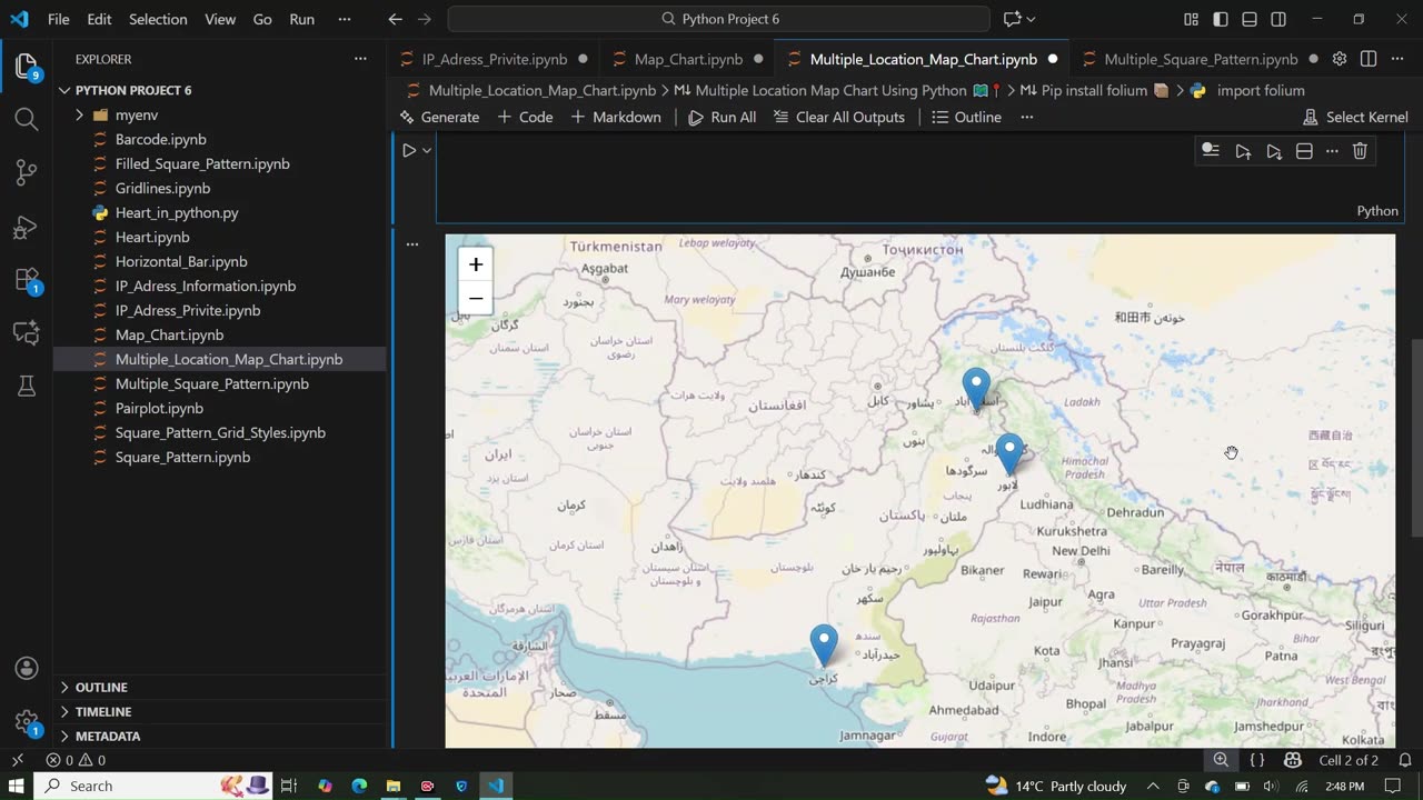
In this video, you will learn how to create an interactive map in Python using the Folium library.
We plot three cities — Lahore, Karachi, and Islamabad — and add clickable markers to display city names.
This tutorial is beginner-friendly and great for students learning Python mapping, GIS, and data visualization.
🔹 What you will learn:
Installing and importing Folium
Creating a base map in Python
Adding multiple city markers
Using popup text and icons
Saving the map as an HTML file
📌 Install Folium (if not installed):
pip install folium
💾 Output file: map.html
You can open it in your browser and explore the interactive map.
👍 Like, Share, and Subscribe for more Python tutorials.
#python #pythonprogramming #folium #pythonfolium #gis
#datavisualization #interactivemap #pythonprojects #pythontutorial
#mapping #learnpython #pythonforbeginners #geospatial
#mapvisualization #pythoncoding
-
 0:23
0:23
AI Evolutionary Technology
24 days agoCreate Desktop Notifications in Python | Step-by-Step Tutorial
3 -
 LIVE
LIVE
Wendy Bell Radio
5 hours agoThe Dominoes Start To Fall
5,927 watching -
 29:51
29:51
The Rubin Report
3 hours agoHow Bitcoin Can Make Election Fraud Impossible | Carlos Toriello
13.7K6 -
 58:53
58:53
The White House
1 hour agoPresident Trump Signs Executive Orders, Jan. 30, 2026
8.2K6 -
 LIVE
LIVE
The Mel K Show
1 hour agoMORNINGS WITH MEL K - Timber!!! The House of Cards Begins to Collapse 1-30-26
937 watching -
 LIVE
LIVE
Film Threat
19 hours agoSAM RAIMI IS BACK TO SEND HELP TO HOLLYWOOD! | Film Threat Livecast
115 watching -
 1:00:29
BonginoReport
4 hours agoIt's Time To SAVE America | Episode 215 - 01/30/26 VINCE
198K121 -
 LIVE
LIVE
LFA TV
15 hours agoLIVE & BREAKING NEWS! | FRIDAY 1/30/26
4,234 watching -
 1:10:19
Graham Allen
4 hours agoIs the Gov't Shutting Down!?! Don Lemon ARRESTED! We Are in FULL FAFO Season
143K557 -
 2:03:28
Badlands Media
8 hours agoBadlands Daily:1/30/26 – Border Enforcement Signals, Federal Authority, and the Enforcement Narrative
44.3K23