Satellite Navigation Accuracy
The Prague-based European Global Navigation Satellite System Agency (GSA) has commissioned RUAG Space to conduct a study to increase real-time satellite navigation accuracy.
“The more accurately the satellite’s position can be determined, the more precise the environmental data it collects and provides. With the more accurate data, for example, the danger to coastal cities such as Venice can be predicted more effectively.”
Fiammetta Diani, Head of Market Development at GSA.
For climate and environmental research, satellites provide extremely important data every day, such as how high sea levels are rising or what effects global warming is having on glacier ice shrinkage in the Alps.
The new study, funded by a one-million Euro ($1.2 million) GSA contract, aims to further increase the accuracy of this space data from climate and environmental satellites.
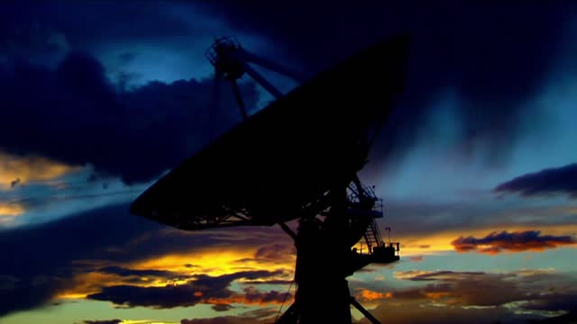
To provide precise Earth observation data from space, the satellite’s position in space must be known as accurately as possible.
To determine the exact position of satellites, RUAG Space’s satellite navigation receivers today use the signals from the 22 European Galileo navigation satellites.
“Currently, there is still untapped potential in the Galileo satellites.
They transmit several signals.
On one of these signals, a new service, the High Accuracy Service (HAS), will support significantly improved positioning from 2022,” said Martin Auer, who is leading the study at RUAG Space.
“When this new service goes into operational use, it will need equipment that can do something with it.
That’s what we’re working on.”
By the end of 2022, RUAG Space will develop a new product in Vienna that will be able to use the new Galileo HAS service.
However, navigation receivers from RUAG Space that process Galileo signals already ensure precise positioning.
These include the Sentinel-6 environmental satellite, which has been in space since November 2020.
It measures the amount of sea level change and provides crucial data on coastal areas at risk from sea level rise.
“The more accurately the satellite’s position can be determined, the more precise the environmental data it collects and provides.
With the more accurate data, for example, the danger to coastal cities such as Venice can be predicted more effectively,” said Fiammetta Diani, Head of Market Development at GSA.
RUAG Space is developing a software update for satellite navigation receivers of the current PODRIX receiver generation already in space, such as those used for Sentinel-6.
This will enable these receivers to increase the satellite navigation accuracy from the current level of about one meter (3.2 feet) to 20 centimeters (8 inches).
“This is a dramatic improvement – a quantum leap – in accurate satellite positioning that will contribute to much better climate and environmental data,” said Heinz Reichinger, the product manager responsible at RUAG Space.
-
 9:12
9:12
Nicholas Bowling
11 hours ago $1.93 earnedPreacher Gets MOBBED in Front of POLICE at Pride Festival!
28.9K29 -
 1:04:12
Katie Miller Pod
12 hours ago $13.99 earnedJoe & Tayler Lonsdale on Tech Investments, Life in Texas, & Homeschooling | KMP Ep. 26
159K15 -
 20:07
20:07
Jasmin Laine
6 hours agoTrump Puts Carney on NOTICE—Stalling for a Majority Just Backfired BADLY
31.3K27 -
 1:28:07
Flyover Conservatives
9 hours agoThey’ve Been Running the World Since WWII (And You Were Never Told) - Mel K | FOC Show
34.3K4 -
 2:49:14
Anthony Rogers
1 day agoEpisode 403 - The Epstein Files
20.3K -
 1:40:50
Adam Does Movies
6 hours ago $0.95 earnedTalking Movies With Murr From Impractical Jokers - Live!
20.1K -
 20:31
20:31
World2Briggs
12 hours ago $0.83 earned15 U.S. Cities With the Highest Murder Rates
15.4K3 -
 7:14
7:14
TheCrsFamily
12 hours agoWOW!!! Another Criminalizing 3-D Printing Bill
16.8K5 -
 13:38:02
LFA TV
1 day agoLIVE & BREAKING NEWS! | TUESDAY 2/10/26
219K39 -
 2:20:35
OFFICIAL Jovan Hutton Pulitzer Rumble
8 hours agoVoting Machines Changed The Votes! Or Did They? You Decide!
21.6K8