Mount Rainier - Tatoosh Range, Pinnacle Peak Hike
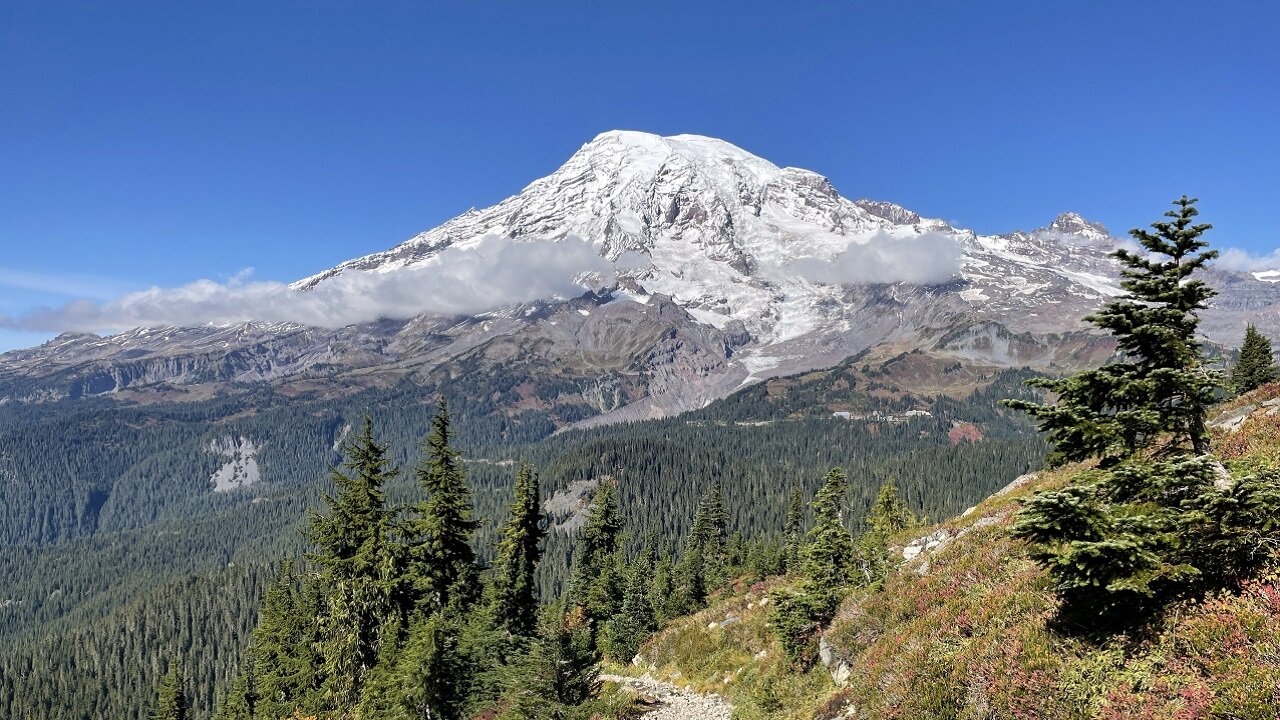
The Pinnacle Peak Trail in Mount Rainier National Park is a short but steep and difficult climb in the rugged Tatoosh Range, offering some of the most dramatic alpine views in the park. Beginning at Reflection Lakes, the trail ascends about 2.5–2.9 miles roundtrip with roughly 1,050–1,574 feet of elevation gain, quickly rising through wildflower meadows and rocky slopes to a saddle at nearly 5,920 feet. From this vantage point, hikers are rewarded with close‑up views of Mount Rainier’s glacier‑covered summit to the north and sweeping vistas of Mount Adams to the south. Though short in mileage, the trail’s steep grade, loose rock, and exposure along drop‑offs make it a challenging trek, but the payoff is spectacular scenery and a chance to experience the dramatic volcanic cliffs of the Tatoosh Range.
Trailhead was at the Reflection Lakes viewing area!
October 1, 2021
Mount Rainier is a large active stratovolcano in the Cascade Range of the Pacific Northwest. The mountain is located in Mount Rainier National Park about 59 miles (95 km) south-southeast of Seattle. With a summit elevation of 14,411 ft (4,392 m), it is the highest mountain in the U.S. state of Washington and the Cascade Range, the most topographically prominent mountain in the contiguous United States, and the tallest in the Cascade Volcanic Arc.
Due to its high probability of eruption in the near future, Mount Rainier is considered one of the most dangerous volcanoes in the world (Bull crap scare tactic), and it is on the Decade Volcano list. The large amount of glacial ice means that Mount Rainier could produce massive lahars that “could” threaten the entire Puyallup River valley.
Between 1950 and 2018, 439,460 people climbed Mount Rainier.
The Wonderland Trail is an approximately 93-mile (150 km) hiking trail that circumnavigates Mount Rainier in Mount Rainier National Park, Washington, United States. The trail offers spectacular unique views on a daily basis and goes over many ridges of Mount Rainier for a cumulative 22,000 feet (6,700 m) of elevation gain. The trail was built in 1915. In 1981, it was designated a National Recreation Trail. An estimated 200 to 250 people a year complete the entire trail with several thousand others doing shorter sections of it. The average time taken to complete the entire trip is 10 to 14 days.
Longmire
Sunrise
Mowich Lake
White River
Summerland
Indian Bar
Nickle Creek
Reflection Lakes
Indian Henry’s
Emerald Ridge
South Puyallup
Spray Park
Grand Park
Devil’s Dream
Windy Gap
Northern Loop
Mowich River
Golden Lakes
Kautz
South Tahoma-Tahoma
Puyallup
North Mowich
Summit
Carbon
Winthrop
-
 2:10:16
TimcastIRL
8 hours agoNEW Epstein Photos Drop, Dems Cherry Pick Photos To Smear Trump | Timcast IRL
179K54 -
 28:11
28:11
Stephen Gardner
7 hours agoTrump’s Genius Move REVEALED!!
19K81 -
 LIVE
LIVE
GritsGG
11 hours agoBO7 Warzone Is Here! Win Streaking! New Leaderboard?
305 watching -
 LIVE
LIVE
Joker Effect
1 hour agoDRAMA NEWS INTERVIEW OF TYSON HOCKLEY! New era of content creation? Will he Box Clav? Networking 101
40 watching -
![tactical pirate setting sail! lets find that booty! [RGMT CONTENT Mgr. | RGMT GL | GZW CL]](https://1a-1791.com/video/fwe2/05/s8/6/c/M/J/H/cMJHz.0kob.y.jpg) LIVE
LIVE
XDDX_HiTower
2 hours ago $0.06 earnedtactical pirate setting sail! lets find that booty! [RGMT CONTENT Mgr. | RGMT GL | GZW CL]
81 watching -
 1:45:59
Glenn Greenwald
9 hours agoGlenn Answers Your Questions On: Looming AI Threats; Controversy Over "Pluribus," Epstein Revelations, CAIR's "Terrorist" Label, and More | SYSTEM UPDATE #558
109K31 -
 LIVE
LIVE
Eternal_Spartan
1 day ago🟢 Eternal Spartan Plays Valheim (Community Server) | USMC Veteran
219 watching -
 LIVE
LIVE
SynthTrax & DJ Cheezus Livestreams
1 day agoFriday Night Synthwave 80s 90s Electronica and more DJ MIX Livestream CARTOONS / RUMBLERS APPRECIATION Edition
207 watching -
 5:21:21
DeadMomAlive
5 hours agoLets dodge, duck, dip, dive, and dodge to catch LEAPERS & kill ARC's! !PREMIUM CREATOR!
16.2K -
 6:50:29
BubbaSZN
9 hours ago🔴 LIVE - 2 TOURNEYS IN 1 DAY (RANKED CUP & SKIN CUP)
15.6K